


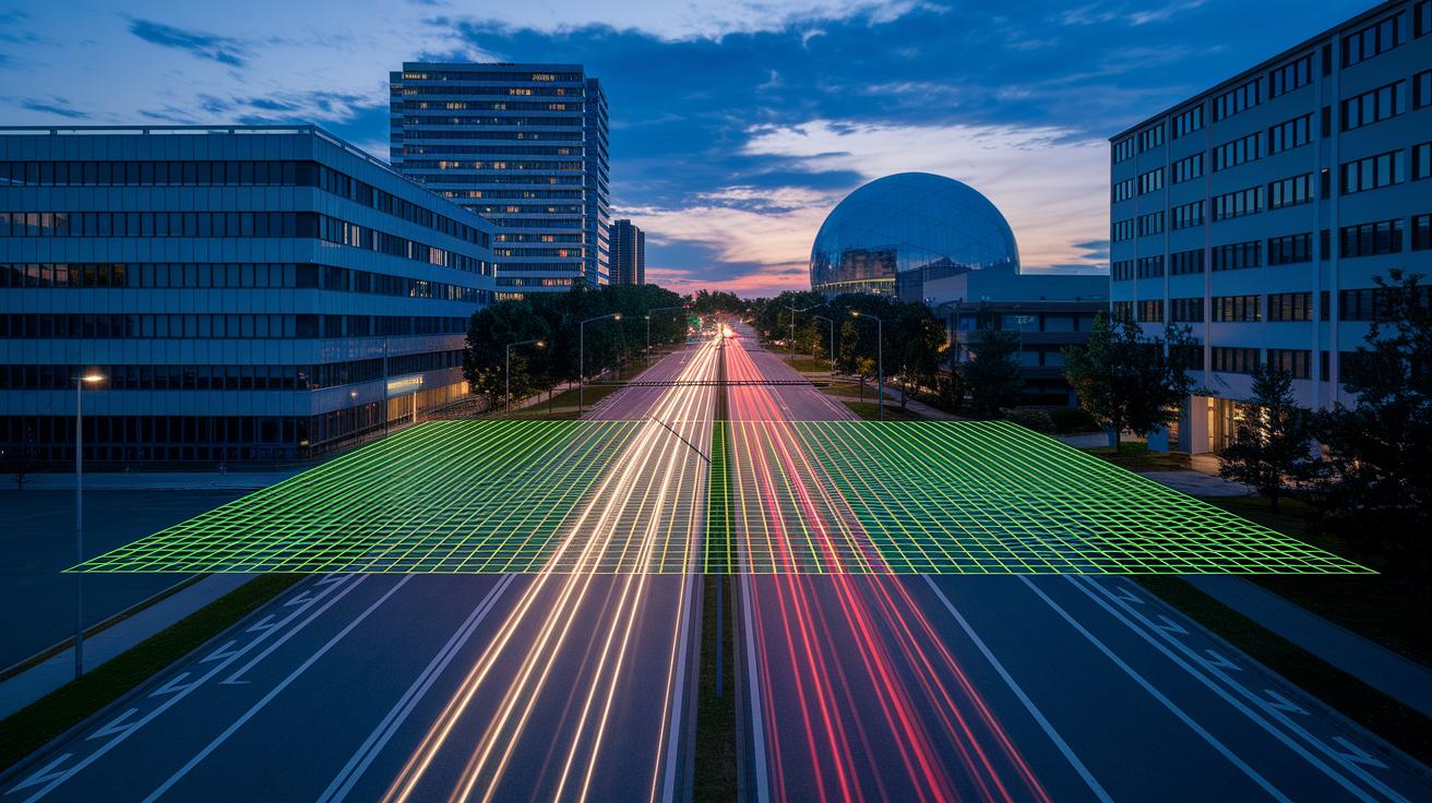
Ever wonder how a space camera can reveal hidden details on our planet? Think of these tools as high-tech eyes that capture clear images and handy data from far away. They come in many forms, like satellites and drones, snapping photos that show tiny shifts in land and plants.
They even measure distances using laser pulses, much like a bat uses echoes at night. Today, we'll take a look at two cool devices that blend smart tech with clear visuals, offering a fresh view of our ever-changing Earth.
Core Instruments of Remote Sensing Technology
Remote sensing devices work like out-of-this-world cameras that capture data from far away. These gadgets are attached to satellites, planes, or drones, and they help us see detailed maps and pictures of our Earth. Think of it like taking a picture from space to reveal cities, countryside, and forests. It’s like snapping a clear, high-resolution photo of a huge landscape, even small shifts in the ground or plant life can be noticed.
Active sensing tools send out their own energy to get information back from the ground. For example, LiDAR devices (which use laser pulses to measure distances) work a bit like a bat using sound to “see” in the dark. Radar systems do something similar by using microwaves (a type of invisible light) to figure out distances and shapes. On the other hand, passive sensors just use light from the sun. Radiometers and spectrometers (instruments that measure light and color) on drones pick up natural light and other emissions, which is very useful for studies that require looking at multiple wavelengths, like multispectral and hyperspectral analysis.
Satellites like those in the Landsat program are great at watching Earth over many years. They capture records of changes in the environment without using their own energy. Meanwhile, drones and UAV platforms offer flexible, real-time images and data that help with mapping and monitoring surfaces almost instantly. Together, these tools form the backbone of modern research about our planet, helping us build a full picture of the world we live in.
Key Active Remote Sensing Devices and Their Functions
Active sensors are like helpful friends in remote sensing. They send out signals all by themselves and then measure what bounces back. It’s much like shouting in a big room and hearing your echo. LiDAR mapping tools, for example, send out laser pulses (tiny beams of light) and capture the returned light to create detailed 3D maps. They time each pulse’s return, much like a bat using sound to feel its way around. City planners and researchers use these devices to clearly map out tricky landscapes.
RADAR units and synthetic aperture radar units also play a big part in remote sensing. RADAR sends out microwave signals (a type of energy wave) that can go through trees, buildings, and more. That means you get clear images even when it’s cloudy or dark. Synthetic aperture radar takes things further by piecing together data from a moving antenna, so you get crisp images anytime. These tools are used for everything from checking on fields to keeping an eye on important structures. They show us how self-made signals can bring out details of the surface, even in tough spots.
Thermal infrared scanners round out this tech mix by using infrared light to spot temperature differences on surfaces. This helps point out warm urban spots compared to cooler, greener areas. It’s a useful way to understand heat patterns that affect local climates and energy use. When all these active sensors work as a team, they give us a real-time, thorough look at our world, guiding practical choices in everything from environmental checks to city planning.
| Instrument | Energy Source | Primary Application |
|---|---|---|
| LiDAR mapping instrument | Laser pulses | 3D mapping of terrain |
| RADAR detection unit | Microwave signals | Seeing through obstacles in all weather |
| Synthetic aperture radar unit | Combined antenna signals | High-detail imaging day or night |
| Thermal infrared scanner | Infrared light | Spotting temperature differences |
Essential Passive Remote Sensing Devices
Passive sensors pick up energy that Earth naturally gives off. Newer models have a finer spectral resolution, meaning they can notice tiny shifts in heat and color. For instance, advanced sensor calibration lets us see small differences in how plants reflect light, kind of like mixing just the right shades to capture a bright sunset.
The Landsat program set a high standard with decades of detailed data from Earth. Today, studies use these sensors to understand urban heat and track deforestation. They now measure things like improved radiometric resolution (how well a sensor measures light) and faster data gathering.
- multispectral data collectors: Snap pictures in different wavelength bands to keep an eye on water, plants, and more.
- hyperspectral imaging tools: Record hundreds of narrow bands to identify minerals and tiny surface changes.
- earth observation instruments: Keep mapping land, oceans, and air with better sensitivity.
- geospatial data collectors: Deliver precise maps from aerial views with enhanced spatial accuracy.
- land cover analysis devices: Study terrain types and environmental shifts using refined spectral data.
- topographic mapping instruments: Chart natural shapes and slight elevation changes with sharper sensor precision.
Improved sensor abilities give us a clearer view of how Earth’s surface works, making it easier to understand the planet one detail at a time.
Remote sensing technology devices Radiate Excellence

Remote sensing gadgets send data into GIS systems through a clear seven-step process. It begins when the sensors create their own energy signals and then adjust for outdoor factors like radiation and weather. Next, they send energy toward a target and record the energy that bounces back.
After the energy is logged, the data travels to a nearby receiver where it’s fully captured. Then, experts process, interpret, analyze, and put the information to work. Calibration methods, both geometric (shaping the real world) and radiometric (measuring light levels), help keep the spatial details true to life. Plus, real-time processing and cloud connections let decision-makers access ready-to-use maps anytime, while data rules ensure a smooth handoff from sensor to GIS.
GIS Spatial Data Workflows
- Energy source initiation: The sensor creates its own energy signal.
- Accounting for radiation and atmospheric factors: It adjusts for environmental shifts.
- Target interaction: The sensor directs energy at an object and picks up its reply.
- Energy recording: The returned signals are carefully logged.
- Data transmission: The sensor sends the logged information to a central system.
- Reception: The system collects the transmitted data.
- Processing, interpretation, analysis, and application: The raw data turns into clear, actionable insights.
Advanced Analytical Tools
Image enhancement algorithms boost image quality by fixing distortions and sharpening details. Machine learning (tech that lets computers learn from data) helps automatically pick out and label features in large datasets. Together, these tools turn basic sensor readings into clear, practical geographic maps that guide smart planning and quick responses.
Industry Applications of Remote Sensing Technology Devices
Remote sensing devices are now widely used to help us care for nature and build smarter communities. They keep an eye on our planet by tracking deforestation (when trees are removed), watching wetlands, and checking water quality. You can think of these devices as smart eyes that spot changes in tree cover and water clarity, which might mean bigger shifts in our environment. For example, taking snapshots from satellites over time gives leaders the clear data they need for important decisions.
Another exciting use is in precision agriculture. These systems use multispectral sensors (cameras that capture different colors of light) to see how healthy crops are. This helps farmers know exactly when to water or add fertilizer to their fields. By closely tracking how plants reflect light, they can manage soil moisture and nutrients more effectively, leading to productive and resource-saving farming. City planners also use similar mapping tools to figure out the best places for new developments while keeping environmental needs in mind.
Natural disaster watching is another key area. Satellite systems monitor floods, wildfires, and landslides, providing real-time information that helps emergency teams act fast. Even mineral exploration benefits from these tools, using hyperspectral imaging (advanced color scanning) and 3D laser scanning (precise measuring with lasers) to find unique underground features.
Coastal erosion monitors take time-series images to track how shorelines change over time. At the same time, water quality devices measure factors such as water haziness and algal blooms. By using both historical and live data, communities get a clear picture of their local environment. This information is crucial for planning everything from smart farming strategies to effective disaster response, all while keeping a watchful eye on nature’s health.
Remote sensing technology devices Radiate Excellence

Modern space imaging tech is changing the way we gather and use data from space. For instance, instruments like Cognitive Space's CNTIENT help manage satellite missions by planning quickly and setting up tasks automatically. These clever systems take care of communication links and can even choose which tasks come first in real time. And there’s now agentic AI (a smart decision maker) in space work, letting satellites decide on their own so we don't have to do everything. Here's a cool fact: modern satellites can change what they do on the spot, kind of like a self-driving car zipping through busy streets.
Miniaturization trends are making a real difference too. Tiny detection arrays on futuristic drones let us keep a close eye from low heights. The modular design of these devices, teamed with sensor fusion (a way to combine different sensor info), boosts image detail and cuts down on power use. These new imaging tools capture a lot more detail in a smaller space, opening up a path for quicker and smarter views of our world. All in all, these breakthroughs not only make operations easier but also bring new possibilities for mapping, studying the environment, and more.
Challenges and Best Practices for Remote Sensing Devices
Remote sensing devices face a bunch of hurdles. They cost a lot and need special know-how, so getting spot-on readings in tricky settings can be hard. Sometimes, they struggle to capture details underground or deep in the ocean. Buildings like bridges or roads can block the signals, and natural factors like the sun’s angle or weather can throw off measurements. On top of that, high-res scans might bring up privacy and legal concerns that need extra care.
But there are smart ways to deal with these issues. Experts suggest a few key strategies, such as:
- Calibrating devices carefully to keep readings accurate (using both light-based and shape-based checks).
- Using simple tricks to cut down on errors.
- Equipping devices with weatherproof parts for rough conditions.
- Doing regular field checks to make sure sensors perform as expected.
- Reviewing costs throughout the device’s life to balance quality and expense.
Following these steps helps overcome both technical problems and rule hurdles, ensuring you still get clear, reliable data. These best practices keep remote sensing projects solid and trustworthy in a variety of settings.
Final Words
In the action, we explored core instruments and shared how both energy-powered and sunlight-based sensors capture Earth’s details. We broke down active and passive systems, highlighted GIS integration, and reviewed industry examples, all while showing how remote sensing technology devices drive data capture and mapping.
This conversation paints a clear picture of tech’s role in our daily lives. It's a reminder that practical innovation can brighten our outlook on the future.
FAQ
What is remote sensing and how is it used in geography?
Remote sensing is a tool that captures data about Earth’s surface from a distance using sensors on satellites, aircraft, or drones. It helps study landscapes, weather, and natural features.
What are the types of remote sensing?
Remote sensing is generally split into active sensors, which emit their own energy, and passive sensors, which rely on sunlight. Each type has unique methods for gathering surface information.
What are remote sensing technology devices examples and which devices are used?
Examples include satellites, UAV-mounted cameras, LiDAR mapping instruments, RADAR units, and radiometers. These devices capture images and data to monitor and analyze surface details.
What are examples of active versus passive remote sensing?
Active remote sensing uses devices like LiDAR and RADAR that emit energy pulses, while passive sensing relies on natural sunlight with tools such as radiometers and spectrometers to capture data.
What are remote sensing platforms?
Remote sensing platforms are the carriers of sensors. They include satellites, aircraft, and drones that support both active and passive devices to gather geospatial data efficiently.
What apps use remote sensing data?
Many mapping and monitoring apps use remote sensing data. These apps support tasks like land management, urban planning, and environmental inspections, offering real-time insights for various industries.